Category: Tube Map
-
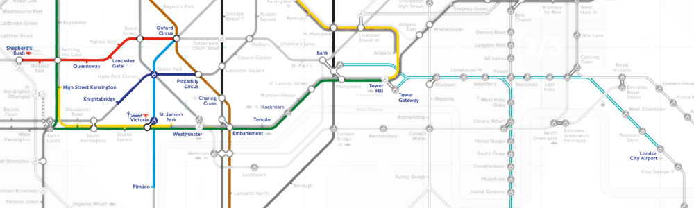
London Tube Map, 2018
Turns out that, while an interesting effect, the ‘coloured-in map’ look is a bit tricky to do, at least if you’re me & you’re using raster data. Probably easier if I was using some sort of vector layer approach, so maybe that’s a thing to look at? ( I’m supposed to be doing some species of online mapping thing for work purposes next year anyway, … ) Also, both the Northern line & Jubilee…
-
Yearly Tube Map Challenge
Some time ago, I ran into a set of ‘rules’ for tracking how much of the London Underground you’ve used in a year. That version had the counter starting on New Year’s Day, but I chose Boxing Day, mostly because the tube wasn’t running on Christmas Day. Me being me, I decided to map it.…